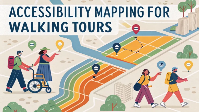
Creating accessible walking tours helps everyone explore and enjoy destinations, regardless of their mobility needs or disabilities.
Essential Accessibility Features to Map
- Surface conditions (even/uneven, material type)
- Slope measurements and gradients
- Curb cuts and ramps
- Rest areas and benches
- Accessible restrooms
- Door widths for indoor portions
- Obstacle-free paths
Route Planning Tips
Map multiple route options to accommodate different mobility levels and stamina.
Consider these key factors when designing accessible routes:
| Feature | Recommendation |
|---|---|
| Path Width | Minimum 36 inches (91.4 cm) |
| Rest Stops | Every 0.25 miles (0.4 km) |
| Maximum Slope | 1:12 ratio (4.8 degrees) |
Documentation Methods
- Take photos of challenging areas
- Record exact measurements
- Note temporary obstacles
- Mark alternative routes
Digital Accessibility Tools
Use these apps to create and share accessible routes:
- RouteCheckr – Maps accessibility features
- Wheelmap – Shows wheelchair-accessible locations
- AccessNow – Community-driven accessibility mapping
Communication Guidelines
Include these details in tour descriptions:
- Total distance and duration
- Surface types encountered
- Steepest gradients
- Location of accessible facilities
- Emergency contact information
- Alternative transport options
Seasonal Considerations
Update accessibility information based on weather conditions and seasonal changes.
| Season | Special Considerations |
|---|---|
| Winter | Snow removal, ice patches |
| Spring | Mud, temporary flooding |
| Summer | Heat shelter locations |
| Fall | Leaf coverage, slippery conditions |
Resources for Additional Support
Contact these organizations for accessibility mapping assistance:
- ADA National Network: 1-800-949-4232
- Local tourism offices
- Disability rights organizations
Regular updates and maintenance of accessibility information ensure accurate and reliable tour experiences for all visitors.
Training and Staff Education
Proper training ensures tour guides and staff can support visitors with diverse accessibility needs.
Key Training Components
- Disability awareness and etiquette
- Emergency response procedures
- Operation of accessibility equipment
- Alternative route knowledge
- Communication techniques
Maintenance and Updates
Regular monitoring ensures continued accessibility of mapped routes:
- Monthly path inspections
- Quarterly accessibility feature checks
- Seasonal route assessments
- Immediate hazard reporting system
Community Engagement
Involve local disability communities in:
- Route testing and feedback
- Accessibility audits
- Tour program development
- Update recommendations
Conclusion
Creating accessible walking tours requires thorough planning, regular maintenance, and ongoing community input. Success depends on comprehensive documentation, proper staff training, and commitment to continuous improvement. Regular updates and adaptations ensure tours remain accessible and enjoyable for all participants year-round.
Future Considerations
- Emerging accessibility technologies
- Expanding route options
- Enhanced digital integration
- Broader inclusion initiatives
FAQs
- What factors should be considered when mapping an accessible walking tour route?
Consider path width, surface type, curb cuts, slopes/grades, rest areas, bathroom access, and potential obstacles like stairs or uneven terrain. - How do you determine if a walking tour route is wheelchair accessible?
Check for minimum path width of 36 inches, firm and stable surfaces, curb ramps at all crossings, grades less than 1:12 slope, and absence of steps or barriers. - What technology tools can help create accessible walking tour maps?
Geographic Information Systems (GIS), Google Maps accessibility features, AccessMap, AXS Map, and Wheelmap are useful tools for mapping accessible routes. - What should be included in accessibility information for walking tours?
Distance, duration, surface types, rest stop locations, accessible restrooms, potential barriers, alternative routes, and emergency contact information. - How often should accessibility information be updated for walking tours?
Updates should occur at least annually and whenever construction, seasonal changes, or reported obstacles affect accessibility conditions. - What are the essential amenities to mark on an accessible walking tour map?
Accessible restrooms, parking spaces, ramps, elevators, rest areas, water fountains, and emergency services should be clearly marked. - How can audio descriptions be incorporated into accessible walking tours?
Include downloadable audio files or QR codes at stops, providing detailed descriptions of surroundings, directions, and points of interest for visually impaired visitors. - What safety features should be included in accessible walking tour routes?
Well-lit paths, emergency phones, clear signage, level surfaces, handrails where needed, and proximity to assistance if required. - How can seasonal weather conditions affect accessible walking tours?
Weather can impact surface conditions, create temporary obstacles, affect rest area availability, and influence overall accessibility of routes. - What alternative formats should accessibility maps be available in?
Large print, braille, digital formats compatible with screen readers, audio descriptions, and mobile-friendly versions with high contrast options.