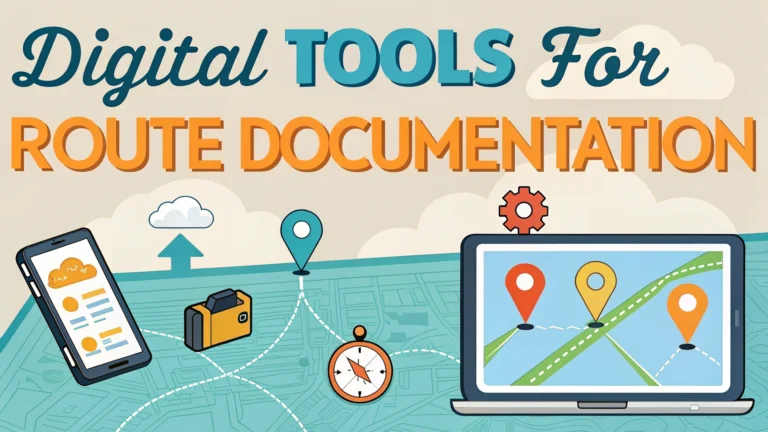
Digital tools have revolutionized how we document and share walking routes, making self-guided tours more accessible and enjoyable than ever.
Essential Route Planning Apps
- Komoot – Excellent for turn-by-turn navigation and detailed terrain information
- AllTrails – User-friendly interface with extensive trail database
- Gaia GPS – Advanced mapping features for serious hikers
- ViewRanger – Augmented reality features to identify landmarks
GPS Recording Tools
Modern smartphones contain built-in GPS capabilities perfect for tracking walks and creating shareable routes.
| Tool Type | Best For | Key Features |
|---|---|---|
| Smartphone Apps | Casual Users | Easy recording, basic stats |
| Dedicated GPS Devices | Professional Tours | Accurate tracking, long battery life |
Photo Documentation Tips
- Take photos at major intersections and landmarks
- Enable location tagging on your camera
- Document trail markers and signage
- Capture seasonal variations
Content Creation Tools
Transform your route documentation into engaging content with these digital tools:
- Canva – Create visual route maps and infographics
- Google My Maps – Custom maps with points of interest
- Relive – 3D video animations of your routes
Audio Guide Creation
- VoiceMap – Location-aware audio tour platform
- IZI.travel – Free multimedia tour creator
- PocketSights – Mobile tour building platform
Data Storage and Sharing
Keep your route documentation organized and accessible:
- Cloud storage (Google Drive, Dropbox)
- Route sharing platforms (Strava, MapMyWalk)
- Social hiking networks (Wikiloc, OutdoorActive)
Pro Tip: Always backup your route data in multiple locations and formats.
Quality Assurance Checklist
- Test the route in different weather conditions
- Verify GPS accuracy at key points
- Check for seasonal route changes
- Update documentation regularly
- Gather user feedback
Remember to respect local regulations and obtain necessary permissions when documenting and sharing walking routes.
Safety Considerations
- Include emergency contact information
- Mark potential hazards and difficult sections
- Document alternate routes and escape paths
- Note cellular coverage areas
- Include nearby facilities and rest points
Accessibility Information
- Surface type and condition
- Trail width and clearance
- Elevation changes and gradients
- Rest area locations
- Public transport access points
Environmental Impact
Consider these aspects when documenting routes:
- Sensitive habitat areas
- Protected species information
- Leave No Trace principles
- Seasonal wildlife concerns
Legal Compliance
- Copyright considerations for maps
- Property access permissions
- Local regulations and bylaws
- Insurance requirements
Route Maintenance
Regular Updates
- Seasonal condition changes
- Construction or closure notices
- Facility updates
- Community feedback integration
Conclusion
Effective route documentation combines digital tools, thorough research, and regular maintenance. Focus on creating comprehensive, accessible, and accurate information while considering safety, environmental impact, and legal requirements. Regular updates and community engagement ensure the longevity and reliability of documented routes.
Final Tip: Establish a systematic review process to keep route documentation current and valuable for all users.
FAQs
- What are the best digital tools for documenting walking routes?
The most effective tools include GPS tracking apps like Strava, AllTrails, and Komoot, smartphone mapping applications like Google Maps and Maps.me, and dedicated route planning software like Garmin Basecamp and CalTopo. - How can I create a self-guided walking tour using digital tools?
Use route planning apps to map your course, add waypoints for points of interest, include photos and descriptions, and export the route to a shareable format. Popular platforms like Google My Maps and MapMyWalk allow easy route creation and sharing. - What features should I look for in route documentation software?
Key features include offline accessibility, GPS tracking capability, waypoint marking, photo integration, elevation profiles, distance calculation, customizable markers, and the ability to export routes in common formats like GPX or KML. - How can I ensure my documented route is accurate?
Walk the route yourself while tracking with GPS, verify intersections and landmarks, double-check distances, confirm accessible paths, and test the route documentation on multiple devices before sharing. - What’s the best way to share my documented walking routes with others?
Export routes as GPX files for universal compatibility, create shareable links through platforms like AllTrails or Komoot, or generate printable PDF maps with detailed instructions and points of interest. - How do I incorporate points of interest in my route documentation?
Add custom waypoints with descriptions, photos, and historical information at significant locations. Most digital tools allow you to embed multimedia content and detailed notes at specific GPS coordinates. - What backup methods should I use for route documentation?
Store routes in multiple formats (GPX, KML, PDF), use cloud storage services, keep offline copies, and maintain physical maps as backup. Consider using multiple apps or platforms for redundancy. - How can I measure and document elevation changes in my routes?
Use tools with built-in elevation profiles like Gaia GPS or Strava, which automatically generate elevation data. These tools typically show total ascent, descent, and gradient information along the route. - What safety information should I include in route documentation?
Include emergency contact numbers, nearest medical facilities, cellular coverage areas, potential hazards, alternative routes, water sources, and rest points. Also note seasonal variations and weather considerations. - How frequently should I update my documented routes?
Review and update route documentation every 3-6 months or after significant events like construction, natural disasters, or seasonal changes. Regular updates ensure accuracy and safety for users.